
The Pan Am Flight 50 flew around the globe and made the following stops:
- North Pole
- Greenland
- London
- Cape Town
- South Pole
- Auckland
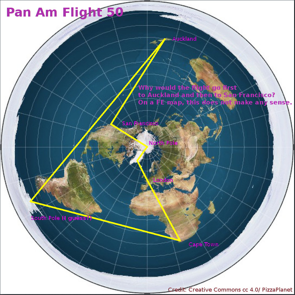
Plotting the flight on a FE map shows a huge problem. The flight went from the South Pole, to Auckland and then to San Francisco. Why would an airplane from the 1970s fly from the South Pole first to Auckland and then to San Francisco? If we plot it on the FE map, this riddle becomes more obvious to us.
Of course on a globe Earth map, this flight path makes perfect sense.